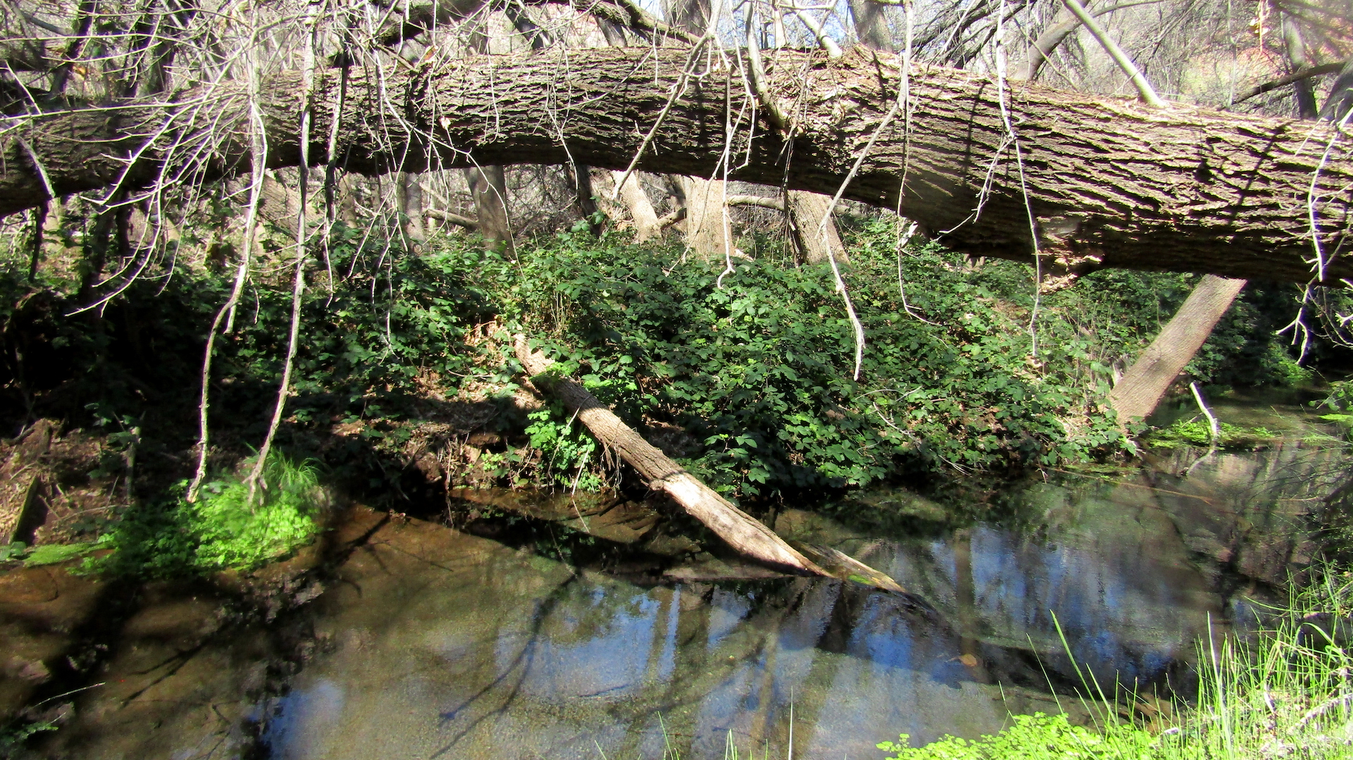
I love the desert because there are so many ways it can kill you,” says Steve Jones in his normal sarcastic tone, as his point is taken that lack of water, flash floods, falling into cactus and fire are just some of the ways this land can take you. The Tres Alamos Wilderness is a good example of the ruggedness of this land.

Hiking with peak-baggers is unlike hiking with anyone else. Peak-baggers hike peaks, often without trails, as they use waypoints on GPS to find their paths, often where other peak-baggers have gone before. Some even use equipment to get up to those peaks, but most peaks don’t demand that.

I hiked — I use the word loosely because there was no trail — Tres Alamos Wilderness with experienced peak-bagger John McCafferty and the less experienced Jones.
McCafferty appears to be the top peak-bagger in Yavapai County and rates among the top 50 in Arizona, with more than 335 peaks. Those conquests are logged on the peak-bagging website. Jones, a retired Chino Valley police officer, has done about ten with McCafferty.

I’ve been to the top of most of Arizona’s mountains, but on trails. Sawyer Peak is the highest point of the Tres Alamos Wilderness at 4,293 feet, and we climbed about 1,500 feet on a 2.6-mile round trip from the jeep.
Afterward I was more wiped out than from a twelve-mile, 3,000-foot climb, because we were bushwhacking while we were climbing, with constant cactus along the way that poked me more times than I’d like to admit. McCafferty said it wasn’t till he got home that he realized he had to pick cactus from his shin. “This is a place that is rarely climbed, and it’s rugged,” he said.
While we got stuck with cactus, none of us fell into it. That’s a concern. A month earlier I was on the Go John Trail in Cave Creek, an easy trail but with a lot of cactus along it. I came across a bloodied hiker because both he and has dog had fallen into cactus. I offered to pull out my first-aid kit, but the hiker was confident that he could make it back to his car all right.
There was no one else on the trail on the Saturday we were there. Records show 26 others who’ve claimed to have bagged Sawyer Peak, but that’s it, and to me it’s doubtful that any other people have been there.

Amazingly, the Tres Alamos Wilderness is in Yavapai County. From Chino Valley it takes about 90 minutes to get to the dirt road that leads into it, and it took another hour in Jones’ high-clearance vehicle to get to our parking spot. Don’t even think about doing this without a high-clearance vehicle.
The most exciting moment came during the drive in, when we saw a badger. It was the first time I’ve seen a badger in the wild, and sitting in the back seat of the jeep I wasn’t able to get a photo. Hawks and other birds were moving about the Joshua trees. Another factor of this trek was few places to sit and rest, and next to no shady spots along the climb.
The road into Tres Alamos is off Route 93 between Congress and Wickenburg. Driving six miles in, you can’t tell that the highway or anything else is out there. Route 93 is known to be one of the most deadly highways, so if you make this drive be careful, it’s one more way the desert can take you.
Covering 8,300 acres, the protected Tres Alamos Wilderness is centered on the south end of the Black Mountains, and its namesake feature, Tres Alamos, is a colorful monolith among them. Established in 1990 by the AZ Desert Wilderness Act, the area is managed by the Bureau of Land Management.

It’s a classic example of the Sonoran-Mojave Desert transition zone, with vegetation including creosote and Joshua trees as well as saguaro and palo verde. Along with the badger the area’s wildlife includes Gila monsters, golden eagles and prairie falcons.
After the recent rains and snowfall I hiked the Peavine Trail to see the water levels, and I was excited to see flowing water there for the first time in months. In about a month the turtles and frogs should be returning.
My next video in the Preserving Arizona Wilderness series is out on my YouTube channel, about the Kendrick Mountain Wilderness. In it have an encounter with an elk, and cover a historic cabin near the top that firefighters have preserved. See the link with this column online at 5ensesmag.com.


A place name doesn’t always tell you where it is, and can be misleading. You would think Havasu Wildlife Refuge would be near Lake Havasu, but we found it in Topock, about 40 miles northwest of the lake and city. Bill Williams River Wildlife Refuge sounds like it should be near the town of Williams, but it’s even farther from there than the Havasu Wildlife Refuge example — it’s in Parker, about 20 miles south of Lake Havasu.
Don’t let these names throw you because bird and wildlife lovers, as well as naturalists, will love both these places. The Havasu Wildlife Refuge can be tricky to find: Google recommended one route that didn’t go through, and the first sign told us to go another way. The sign leading into Lake Havasu Wildlife Refuge is off the road and can only be seen from a certain angle, so we missed it a couple of times before we found it.
There’s not much of a hiking trail here, but there are views of the marsh and you can walk for some distance along it. The refuge hosts 318 species of birds, and it took us just minutes to spot a beautiful white egret. Coyotes, foxes and bobcats live in Havasu Wildlife Refuge, with some bighorn sheep in its higher reaches.

This area offers much more in terms of hiking trails. The trails are open seven days a week, but you park by an office that’s only open Monday-Thursday. You can head north and hike several miles along or near the shore of Bill Williams River, a tributary of the Colorado River. If you head south from the parking lot, the trail is only about a mile long, but it offers many interpretive signs about the birds and animals along with plenty of benches. There’s a tortoise enclosure a couple minutes from the office, but the tortoise didn’t come out while we were there.
The northwestern part of the state does not get as much hiking attention as Flagstaff to the north, Mt. Baldy to the east or Mt. Lemmon to the south, but it does have some entertaining trails that hikers can use to warm up during the cold winter.

Another trail we took while in the area was the 4.5-mile round trip from Lake Havasu State Park to London Bridge, hugging the lakeshore. Few people take this route because is ends in the tourist area. I noticed two points along the trek that stood out.
First was a cactus garden with interpretive signs explaining everything from the Pygmy Palm Tree to various cacti and other flora in this terrain, which is at sea level. A beautifully painted mural with owls featured wasn’t just for pretty; the site is home to Western burrowing owls, which eat rodents and scorpions.
The second point of interest was a replica of the historic Cape Henry lighthouse at the southern tip of Chesapeake Bay, in Virginia, that was built in 1881 and stood 157 feet ball. The replica stands about ten feet tall and was built in 2017 to provide some history along with light to help guide boaters.

Those looking for a more local hike can urn to the Highline Trail in Sedona. Like most Sedona hikes, the parking lot fills up quickly, so get there relatively early. The scenery is great, but don’t look for a lot of quiet here: air tours and other planes keep the skies buzzing. Aside from hikers, tons of bikers use this trail. Most are courteous, but some whiz by so fast it can feel dangerous. The trail takes trekkers by famed Cathedral Rock. For me the highlight is where it dips down into Oak Creek. The cascading waters and boulders that dot the banks make it magnificent. Going in February meant it was too cold for a dip, but folks were enjoying picnicking and fishing. One huge tree along the bank was the perfect stop for a snack or lunch.
The Highline Trail is a seven-mile moderate hike that climbs about 800 feet, and the uphills can be rocky. Some of us older hikers went up slowly, watching our steps so as not to trip. Then a thirtysomething bopped up the hill like it was nothing, reminding me that the rating of a hike can vary widely by the hiker.
To get there start from the Yavapai Vista trailhead for Hermit Trail, head north, take a left onto the Templeton Trail, follow it all the way around Cathedral Rock and down to the creek, turn left onto the Baldwin trail, then left again onto the Highline Trail. That will take you up over the Cathedral saddle and back down nearly to the parking lot, from where you can take a left on the Slim Shady Trail, then right to the Kaibab Trail to reach the parking lot, or just bushwhack to the Kaibab Trail to the parking lot.
These were all places I hadn’t been previously, reminding me of the great variety that Arizona offers us hikers.
It’s a little hard to imagine when we drive our big-city streets in Arizona that the people the archeologists call the Hohokam were here long before us, just a matter of a few hundred years ago.
Hiking to the top of Elephant Mountain in the Spur Cross Recreation Area in Cave Creek gives hikers a glimpse of Hohokam-era ruins, archaeological sites and fort-like structures that they used as lookouts.
You climb about a thousand feet on this just-under-eight-mile loop, but the trek to the top is well worth it, as you can close your eyes and imagine what life may have been like then. The views are stunning of the surrounding mountains and cities in the distance.

Early on signs warn hikers that the trail is not maintained, which means it’s rockier than many would like. This trail is rated moderate; some might consider it more than that.
Elephant Mountain Trail is open to horseback riders, but not recommended for novice equestrians. One small group on horseback passed us on the trail. This is also the longest trail in the Spur Cross Recreation Area and not as busy as most of the other, easier trails.

One of the joys of visiting Spur Cross Conservation Area in past years has been the streams that run through it thanks to Cave Creek, but with the drought the streams are bone dry this year.
One highlight of Spur Cross Recreation Area you shouldn’t miss is the solar oasis. This is a solar pond, located off Metate Trail just two-tenths of a mile from the Spur Cross Trail that leads to Elephant Mountain Trail.

This is a great place to chill out and watch wildlife. Arizona Game and Fish has placed a wildlife cam here that you can watch on its web page, but it’s better in person. During recent visits, bright red cardinals posed for me among many other birds. A mule deer came to the water to drink. A handful of quail passed by. One of the recreation area’s volunteers spoke about a bobcat that had come to the water the previous day.

The Spur Cross Conservation Area offers twelve miles of hiking within 2,154 acres. There are at least six different connected trails in the conservation area.
On the south side, the Jewel of the Desert trust land offers a unique riparian area that connects with Go John Trail in Cave Creek Regional Park and eventually to trails leading to Anthem. The north side of Spur Cross borders the Tonto National Forest, which offers a multitude of trails.
Spur Cross trails are clear and few get lost, but many more get lost in the Tonto National Forest. Those heading into the forest should take along the Maricopa County Sheriff phone number, 602-876-1000. Spur Cross literature promises a scenic, diverse, rugged upland Sonoran desert habitat. The remnants of a ranch and gold mine can be found here as well. It was the last site added to Maricopa County Regional Park System, in 2001.
The trail is open to hikers and horseback riders. No motorized vehicles are allowed. Pets are welcome, but must be leashed. Spur Cross Stables are just to the right as you drive into Spur Cross, for those who want to see it on horseback.
If the 90-minute drive to Cave Creek seems like a lot, you have Copper Canyon Trail in Camp Verde as a nice option. This is a five-mile loop hike offering switchbacks, dry stream crossings and in better times a waterfall. You won’t likely find water in Copper Canyon this year, though.
The large dirt parking lot at the trailhead is equipped with outdoor grills, covered picnic tables and a pit toilet. The trail climbs about 520 feet, 300 of that in the first mile. Still, this is an easy hike, with switchbacks leading to a ridgeline.
The top of the ridge gives views of I-17. The ridgeline displays an interesting blend of desert and mountain terrain, with views of the red-rock geology of Sedona and in winter the snow-capped peak of Humphreys Peak. Ponderosa pines, southern sycamores in the dry creek, scrub oak and an occasional pinyon pine dot the landscape. A good spot for a lunch break is available by a large fallen tree trunk that acts as a bench about halfway into the hike. The trail is smooth. You’ll encounter a large round, rusted brown-red tank toward the end of the hike that ranchers may have used to store water in the days.
Copper Canyon Trail is only about ten minutes from Rockin’ River Ranch State Park, the in the state-park system, and the reliable Verde River. Drought has slowed the Verde, but not stopped it.
This was a case where the easy-to-moderate trail was hard beyond belief, and the strenuous trail was mostly easy.
It shows that you can’t rely on even the best hiking books for trail descriptions, because the trails change over time due to flooding, fire and other conditions. Look at Havasupai, which has major floods about every ten years, and imagine the impact that has had on the trails.

Our first goal was to hike the Mescal Ridge Trail in the Hellsgate Wilderness, which begins at the Bear Flat trailhead about 18 miles east of Payson. The trouble is I was using the Arizona Highways Hiking Guide edition from 2011. My suspicion is that there was once trail here. So my New Year resolution is to download the All Trails app, because it tells you where the trail is and when you’re off it.
This trail was rated moderate in the Arizona Highways book; it describes a bit of an uphill for the first half mile, and then it would even out. That may still be true, but we didn’t get that far. It does describe that half mile as “hellish.”

The Bear Flat trailhead leads to the beginning of a trail, which starts uphill. Readers are told to follow the fenceline of a bordering private property, but not that the trail then disappears. Maybe it didn’t in 2011.
This was the hardest half mile I can remember. I’ve hiked Arizona’s three highest mountains, the San Francisco Peaks, Mount Baldy and Escudilla. I’ve hiked the north and south rims of the Grand Canyon. None has a tougher half mile, because they all have trails.

Aside from not having a trail going from Bear Flat to Mescal Ridge, the terrain was straight up on extremely slippery soil, with catclaw and cactus on the side away from the fence, leaving no opportunity to hold onto a tree or pull yourself up.
Fellow hiker Larry and I decided the best way to make the ascent was to keep pulling ourselves up using the fence. Some of the fence wire was barbed, so we had to watch where we placed our hands. It was a grueling slog, but we made it most of the way up — then we decided to turn around because we didn’t want to descend that non-trail in the dark.
The Arizona Highways book also states that the Bear Flat trailhead is 4.5 miles down Forest Service Road 405. That part is true, but it doesn’t describe the steep descent on one lane of gravel most of the way, making it hard for vehicles to pass.
So it was no wonder that when we reached the bottom, even though it was a Saturday, there were no other vehicles in the parking area, which offered an immediate, beautiful view of Tonto Creek.
The creek also crosses a concrete driveway to a private property on the other side. Water gushed over little waterfalls into the creek, and to get to the trailhead we walked through about an inch of water over that driveway, where the creek flow was as wide as parts of the Verde River. Keep this in mind if you’re going in the wet season.

Once we gave up on Bear Flat Trail, we decided to do part of Hellsgate Trail #37. This is rated as strenuous because it’s 16.2 miles long, with some deep descents. A sign at the trailead warns of the tough terrain, that the trail is rocky, and if you need rescue no one may be coming for you, so have your own emergency plans.
It was now late in the day, so we only went two and a half miles in. This section of trail was great compared to Bear Flat, and the contrast felt like we were almost running. This section of Hellsgate Trail had quite a few minor ups and downs with a little scree, but it was an absolute joy compared to Bear Flat. Our turnaround was where the trail started to descend, and this was a great place for a snack, with marvelous views.

Adding insult to the situation, on the way into Hellsgate we saw a sign saying Bear Flat was four miles away. This may lead to the top of Bear Flat, where we may have been able to walk into Mescal Ridge, bypassing that hellish half mile.
Come spring I’ll have to see whether that’s the case, and plan a longer hike on Hellsgate Trail.
Why do we hike? Some hike for physical activity, and walk so fast they don’t see the beauty in front of them. Some hike for birding, and go slowly so they can see every bird. There is no wrong way to hike, we each have our own.

I fall between these extremes because I’m always looking for conservation factors. What wildlife is along the hike? Does it have streams or waterfalls? Does it have scenic views? Does it have beautiful trees or flowers? Is this land that should be preserved, and why? What types of recreation should be available, such as hiking, camping, fishing, rock-climbing?
The Glassford Summit Trail in Prescott Valley is a moderate hike of about five miles round trip, and climbs about a thousand feet, with the summit providing beautiful views.
But that’s a small part of the story. My beloved pronghorns are here, but in declining numbers. Pronghorns also range near my house in Chino Valley — I’ve seen herds off Reed Road and near Territorial Elementary School. Some have wandered into my neighbors’ yards. I’ve been within 25 feet of them, and they are majestic. Given how often cars slow or stop to admire them, it's clear any feel the same way.
Walt Anderson, with the recently formed Central Arizona Wildlife Alliance, spoke about the declining pronghorn population during a Sierra Club-sponsored hike on Glassford Summit Trail. Jenny Cobb from the Sierra Club led the hike.

Cobb pointed out that the grassland habitat is being replaced with houses and roads. Anderson said if something is not done soon, the few remaining pronghorns on and around Glassford Hill will die out. The planned Granite Dells Regional Park and Preserve is important habitat, but is already isolated by roads and other development.
“The key is municipalities need to work with the state and all landowners to solve this problem,” he said. “Pronghorns need more connectivity for more habitat. More wildlife corridors are needed.”
The Prescott Valley-area grasslands are the prime habitat for these beautiful animals, but Arizona Game and Fish has relocated some from here to other areas where they are decreasing.Joanne Oellers of Save the Dells and the Central Arizona Wildlife Alliance encouraged the hikers to engage with agencies and municipalities to keep wildlife protection a high priority in road-building and development conversations.
There were 21 hikers on this Sierra Club outing, more than most hiking clubs get for most hikes, illustrating the widespread interest in saving our pronghorns.

I recently hiked a section of the Prescott Circle Trail with the Prescott Hiking Club, led by Ken Paris, who probably knows this trail better than anyone. On a cool Saturday morning we covered this five-mile section at a fairly quick pace. Paris did not talk much about the trail, letting us just see it for ourselves. The hike began at Willow Lake, always a great place to explore for birds and wildlife.
Another reason for hiking is exploring. Sedona’s Bell Trail is one of my favorite hikes, and I recently led an Arizona Trailblazers hike there. My fellow hikers were ecstatic because while they’d been on it before, they hadn't seen some of the parts I showed them.
The trail is best known for an area called the Crack, a diving area that college kids love to visit on spring break. It’s a great place for lunch and snacks, ands well worth seeing for West Clear Creek and the rock formations they jump from.
But there are other, less traveled places worth seeing as well. About three quarters of a mile in you can make your way down to West Clear Creek, where it’s as wide as a river, and you can hear the cascading water while sitting among big cottonwoods and sycamores.
About 2.5 miles in you come to the wilderness sign, and this is where Bell Trail starts to climb. The Weir Trail branches off to the right; this short trail is well worth taking, leading to a mini-dam, where the USGS has a water-monitoring station. Most hikers don’t find this serene space, with great places to sit and enjoy the creek.
Just a little further down Weir Trail you can fight through some brush to get to the creek and see the spring feeding it.
Jenny Cobb, a Prescott resident and active member of Great Old Broads for Wilderness, leads a campout hike to Mt. Baldy each July.

East Baldy climbs from 9,200 to 11,350 feet, so you don’t want to go at this time of year, but it’s never too early to start planning for next summer. Later on the day we left a hailstorm hit the campground and damaged some of the vehicles.
Local daytime temperatures recently plummeted from the 90s into the 40s quickly, leaving frost on our vehicle one morning in mid-October. No one watches weather closer than hikers, because you don’t want to get caught unprepared for heat or cold.

Mt. Baldy is the second-highest peak in Arizona, but unlike Humphreys Peak (12,637) and third tallest Escudilla Peak, the Baldy Peak trails have water throughout, tempting to tired feet. Beautiful meadows dot the trail, along with boulders similar to the Granite Dells.
The early part of East Baldy Trail follows the East Fork of the Little Colorado River, a stream that’s not only beautiful, but also managed to support the endangered Wild Apache Trout. Brook, rainbow and cutthroat trout help to make this a fisherman’s paradise.
This is one of the most dense areas in the state for black bear. Mexican grey wolves are in the area as well, along with mountain lions, mule deer, elk and coyotes.

Mount Baldy Wilderness is one of 90 wilderness areas in Arizona, and at 7,079 acres among the smallest. There are three hiking trails: East Baldy, West Baldy and Crossover Trail, which connects the two.
You can’t get to the top of the trail without a permit, because it’s on the White Mountain Apache reservation. Please don’t try to do this, the land is sacred and should be respected. If caught you can be fined and your backpack confiscated. Good signage reminds you not to trespass.
East Baldy Trail begins near a beautiful alpine meadow, but you quickly enter the forest, which includes Engelmann spruce, Douglas fir, Colorado spruce and quaking aspen in the higher elevations. Flowers are also plentiful in summer.

This moderately difficult hike covers 14 miles, but you can turn around at any point.
You may feel the elevation, but there are plenty of downed logs along the trail perfect for snacks or lunch. The further you go up the trail, the more sandstone rock formations you’ll see, as well as great views of the surrounding mountains.
The Great Old Broads organization began in the 1970s and successfully lobbied to designate some of our wilderness areas. Cobb continues to advocate and educate about Arizona’s 90 wilderness areas. She is also a gourmet chef, and treated campers to great low-cost breakfasts and dinners each day.

The drive from Prescott to Mt. Baldy takes more than five hours, but there are many trails, lakes and fun places along the way. Lee Valley Reservoir is just a couple miles from Baldy and offers a serene place to fish, boat or hike.
Mt. Baldy is accessible to all vehicles. Dogs are allowed but should be leashed.
The East Baldy and West Baldy trailheads are only about four miles apart, with Winn Campground between, making a great place to camp among the aspens.
Directions: From Show Low drive about 39 miles east on Highway 260. Turn right on Highway 273 and drive four miles to the trailhead on the right. For more information, phone the Springerville Ranger District at 925-333-6200.
Most of the Flagstaff and Mogollon Rim hikes are behind me for this year as I start on some Prescott and Sedona-area hikes before it gets too cold, then it’ll be time to head south.
For my YouTube channel Preserving Arizona Wilderness we just released our latest video, on East Baldy Trail. Professional videographer Zach Kline and his wife Sushi produced this wonderful video.
youtube.com/watch?v=BkzssNkrEPU
Barbershop Trail #91 on the Mogollon Rim offers historic cabins, a mini-dam, ferns, flowers and a decent amount of shade.
This is a great summer hike, rising from 7,665 to 7,811 feet in elevation. This may not sound like much, but there are several ups and downs as the trail winds through about six canyons, including Dane Canyon and its scenic boulders. It may be even better in the fall as the maples, aspens and oaks put on their fall colors.

Barbershop Trail is nine or ten miles long, depending on whose GPS you’re using and how often you wander off-trail. It’s among the easier trails to get lost on, so keep your eyes on the trail and watch for cairns.
This is an in-and-out hike, so you can return at any point, and it’s also part of the 18-mile Cabin Loop Trail, so you can also make it as long as you like. We saw the remains of a couple of recent campfires along the way.
The hike quickly descends into a fern forest, with wildflowers making it very photogenic. The ferns grow to about four feet tall, not like the seven-foot thickets along Kachina Trail, but still a beauty to behold.

The trail continues with some rocky slopes to navigate. Toward the end you cross a large, pretty meadow, but again, follow the trail and signage to stay on track.
The Barbershop Trail turnaround is the Buck Springs Fire Guard Station, consisting of two cabins, the smaller one built in 1932 and the other in 1946, and signs alert the hiker to their historical nature. The cabins are still used sometimes in summer to house fire crews. An old barbecue grill sits outside one of them.


Oddly there is no sign pointing out the mini-dam about a quarter mile behind the cabins. The dam creates a nice riparian area with rocks large enough to sit on, making it perfect for lunch or a snack as blue dragonflies dance around the stream. I imagine some of the firefighters built the dam.


The trail’s catchy name apparently refers to a local sheepherder who sheared sheep and cut the hair of his fellow shepherds as well. The local wildlife includes wild turkey, mule deer, elk and black bear.
Barbershop Trail ranks among the Arizona Highways top 52 day hikes, yet on the Saturday we were there no one else was on the trail. The magazine rates the trail as moderate, but that’s only if you don’t get lost — and watch your footing.
There are no restrooms; dogs are allowed only on leash. You’ll prefer a high-clearance vehicle for the road to the trailhead. More information is available from the Mogollon Rim Ranger District at (928) 477-2225 or fs.usda.gov/coconino.
Directions: From Payson drive north on State Rt. 87 for 28.5 miles to Forest Road 300. Turn right and continue 16.6 miles to FR 139, and continue 1.9 miles to the trailhead on right.
Hikers, you have to think about the heat before you hit the trail. The Phoenix area has hiker rescues almost every day during the heat. Some hikers have died from it, including at the Grand Canyon. This is an issue that we have to take seriously.
While the Prescott area doesn’t get as hot as Phoenix, and might feel cool to those coming from the Valley, it has still been consistently over 90 degrees. That means taking plenty of water and hiking early or late, preferably on trails with lots of shade.
About a month ago I hiked Skunk Canyon to Fisher Point just south of Flagstaff. We were at about 6,700 feet; by the time we finished the hike it was about 93 degrees, and we were all feeling it.
My general rule for the hottest parts of the summer is to get above 8,000 feet. The San Francisco Peaks Trail is closer to 9,000 and an easy hike, because it goes around the mountain rather than up it, and you still enjoy lots of aspens and ferns.
Hopefully it will cool quite a bit in September so we can enjoy Groom Creek Loop Trail, which rises from 6,400 to 7,693 feet. Usually that’s high enough to cool people down, but during the thick of summer it can still be hot. I hiked it in April, before the heat set in.

Groom Creek Loop Trail 307, which touches the top of Spruce Mountain, is one of the best in the Prescott National Forest and among Arizona Highways’ top 52 day hikes. The views from the top are amazing, and trees and boulders shade the trail periodically. It climbs about 1,300 feet, but most of the elevation comes so gradually that you hardly notice it.
The trail is so well manicured I felt I was sometimes walking on carpet, especially early on, paralleling Forest Road 52, where you can hear kids’ voices from nearby summer camps. Further up the sounds disappear, but this is a popular and sometimes busy trail. Mountain bikers and horseback riders also like Groom Creek Loop.

Alligator junipers, oaks and Ponderosa pines dot the trail, with more evergreens toward the top. Flowers and Mexico locust trees give the trail color.


Reaching the top not only gives a sense of accomplishment, but there are picnic tables in several places, and this is the perfect place for lunch or a snack as you take in the scenery. Hiking buddy and Cornville resident Chris Appleton and I munched out, then took in the view from the top.
The signage at the top of the trail isn’t great. There is a jeep trail off to the left that’s tempting to follow, but not part of the trail, which goes straight ahead, then veers right, but you have to be watching for the #307 trail sign. A fire tower is at the top, and if someone’s there you can visit. If not, the view from the bottom of the fire tower is magnificent.
Groom Creek Loop totals under nine miles, and those looking for more mileage can also take Isabella Trail on the way down. Arizona Highways rates Granite Creek Loop Trail as moderate. There are restrooms a both the trailhead and the top of the mountain. Dogs are allowed and must be leashed.
For more information phone the Bradshaw Ranger District at 928-443-8000.
From Prescott, take Mt Vernon Avenue (Senator Highway) south from Gurley Street, and take Forest Service Road 52. Go 6.4 miles, and the trailhead parking lot is on the left.
The Bear Wallow Wilderness provides a stark contrast between natural beauty and burned-out areas caused by man’s recklessness. The hiker may notice it quickly, as ferns carpet much of the beginning of the trail, with aspens and other trees painting the picture till you look up to where the landscape has been marred by fire.

The Wallow fire, which remains the largest wildfire in Arizona history, began in Bear Wallow Wilderness, but extended far beyond it. The US Forest Service, which manages the land, has great signage about the fire at the trailhead, detailing what happened and warning us to be cautious of falling trees and erosion-related flooding. It urges hikers to look up, look down and look all around, which I think is always good advice.
In 2011 two careless backpackers left a smoldering campfire by Bear Wallow Creek. The flames that trashed this wilderness and others, evacuated several towns and extended into New Mexico generated $79 million in suppression costs.
The hikers returned from a day hike to find their camp full of smoke and fire, and fled the wilderness, leaving their gear and two dogs. A deputy sheriff picked them up on a road along the Black River, more than six miles away. One dog died. They were later convicted of leaving the fire unattended, and sentenced to community service and fines totaling $3.7 million. It’s so sad, because it might have been prevented if they hadn’t left a candy wrapper in the fire.
The many downed trees and burned patches are reminders of the Wallow Fire and at least one much smaller, more recent fire. But beauty remains here. It’s still home to one the most dense populations of black bears and other animals in the state. A small, spectacular Arizona tree frog greeted us. Flowers of all sizes and colors were also abundant during our July trek, including the tiny harebell. Beautiful meadows also capture onlookers.

Prescott residents Dan Cook, Zach and Sushi Kline and myself were on the trek, and we didn’t see anyone else on the trail. The Bear Wallow Trail is about 30 miles south of Alpine and eight miles southeast of Hannigan Meadow. It’s about as close as you can get to New Mexico without being in it. Part of the Apache National Forest, the 11,080-acre Bear Wallow Wilderness is named for its wet, boggy areas, where black bears roll to keep cool and rid themselves of insect parasites.

The trail starts at 8,720 feet with a descent into alpine forest that includes quaking aspens. It drops to 6,657 feet over 15.2 miles, but this is an in-and-out hike, so you can turn around whenever it suits you. The Bear Wallow Wilderness hosts the largest stand of Ponderosa pine in the Southwest, as well as a blanket of pine, fir, and spruce. Birds are plentiful here, including woodpeckers, and the area provides habitat for the endemic and threatened Apache trout.

Five trails offer foot and horse access to Bear Wallow. The Reno Trail #62 (1.9 miles) and Gobbler Point Trail #59 (2.9 miles) drop into the canyon from easily accessible trailheads on Forest Service roads. Bear Wallow Trail #63 follows the rocky stream bed 8.2 miles to the boundary of the San Carlos Apache Indian Reservation. Schell Canyon Trail #316 (2.8 miles) connects with Bear Wallow Trail and the canyon floor to the Rose Spring Trail #309 (4.5 miles), which skirts the southern boundary along the Mogollon Rim. Visitors to the San Carlos Reservation must have an advance permit. For information and permits, write the San Carlos Tribal Office, Box O, San Carlos, AZ 85550.

Bear Wallow Wilderness is part of the 110 million-acre National Wilderness Preservation System, which provides clean air, water, and habitat critical for rare and endangered plants and animals, as well as opportunities for challenging activities like hiking, backpacking, climbing, kayaking, canoeing, rafting, horse-packing, birdwatching, stargazing, and extraordinary solitude.
This was a damned beautiful hike.
Damned because plan A didn’t work out. We planned to hike Wabayuma Peak Wilderness on Hualapai Mountain south of Kingman. When most people think of summer hikes they think of Prescott and Payson before it gets too hot, then when the thermometer goes up it’s off to Flagstaff or the Mogollon Rim. But the Hualapai Mountains offer more than 15 trails, all above 6,000 feet, and our trails were closer to 7,000.

Kingman is not far from the Yavapai County line, about a two-hour drive from Prescott. Hualapai Mountain Park offers plenty of camping options for campgrounds, RVs and cabins, operated by Mohave County Parks.
But back to our misadventure. For the Wabayuma Peak Wilderness hike, we were following the Falcon Guides Hiking Arizona guidebook, but its directions were pretty far off. The trailhead was supposed to be four miles from Hualapai Mountain Park, and when we neared that spot a sign told us the trailhead was another 14 miles away. That wouldn’t have been a big deal on a paved road; this was far from smooth. Even in our SUV the road was rough, and if it continued that way it would have taken us at least an hour more each way, time we didn’t have.
Always have a Plan B hike, especially in this time of year, when fires can close trails.
Our Plan B was Aspen Peak Trail in Hualapai Mountain Park. This was not a bad choice, since it’s among Arizona Highways’ 52 best day hikes. This trail rises from 6,710 to 7,919 feet, with fabulous views.

Flowering trees, including New Mexico locust, and red and yellow cactus flowers light up the trail. You’ll cross an old footbridge, just don’t jump up and down on it, because it’s pretty worn. A bench at the summit calls to hikers to take a rest.


Much of Aspen Peak Trail was built by the Civilian Conservation Corps in 1937. You have to take other trails to get to Aspen Peak Trail, so this moderate hike turned into a seven-miler as we rose 1,200 feet in elevation.
You start at Forest Army Way Trail, which leads to Potato Patch Loop, which leads to Aspen Peak. You’ll pass an old water station among aspens and an old Boy Scout facility called Levi Levi Camp, just before you reach Aspen Peak Trail.
Besides the aspens you’ll be walking among chaparral, pine, oak and fir.
We saw a few fire-recovery signs along the way, as well as several burned-over areas. Locals familiar with this maze of trails told us that some of them had to be rerouted because of the fires.
Another interesting waypoint before you get to Potato Patch Loop is Stone Step Lookout, which is well signed and takes you only about a quarter mile off the trail. The stone steps take you to a natural lookout that’s well worth a look.
For more information phone 928-681-5700. The directions are complicated.
A few weeks ago I was hiking the Groom Creek Loop in Prescott. This nine-miler is one of our best maintained local trails. It seemed so easy I was going faster than usual, and not watching my feet. I hit a tree root and literally went flying, bruising my knee, scraping my arm and ruining my pride. So remember to go at a pace that’s right for you, and keep your eyes on the trail!
On the lower end of the huge Sycamore Canyon Wilderness near Clarkdale, Parsons Spring Trail offers one of the best riparian hikes in the state.

Hikers can see the promised water from the trailhead, up on a hill that gives a view of Sycamore Creek below. You have to descend about 200 feet, then the trail is fairly flat the rest of the way.
About a mile in you’ll come to Summers Spring, and you can even find its headwater as it bubbles up. This is a great place for a snack or lunch in clear water where branches cross the spring. Watercress, which many put in salads, is plentiful here, and later in the hike we found it in bloom.
A little farther down the trail Sycamore Creek becomes more plentiful, and you have to cross the creek three times in each direction. Expect to get a little wet. The amount of water will depend on spring runoff and recent rains. When we were there, toward the end of winter, each crossing meant we would get wet to about our knees.
Great hikes are even better when you go with great people, and this excursion included Prescott naturalist Dave Moll, Skyliner Hiking Club member Chris Jensen, my videographer Zach Kline and his soon-to-be-wife, videographer Sushi.

We were shooting our next video for our YouTube series Preserving Arizona Wilderness, which will be out in June.
Another highlight of this trail is the Blue Hole. No one knows why it’s called that, but it’s an area ringed with cliffs, where the water is deep and courageous souls during the summer use it as for diving. It also has a natural beach where you can either watch the divers or just sun yourself. Swallows use the cliffs for nesting and can be seen flying in and out. Hawks, golden eagles, hummingbirds and other birds are plentiful here, along with ground-based wildlife including mountain lions, badgers and black bears.
Sycamore Canyon Wilderness is among the oldest and largest wilderness areas in Arizona, designated by Congress in 1972 and covering 55,937 acres. Sycamore Canyon is the second-largest canyon in the state. There are 15 trails in the Wilderness area, including Sycamore Rim Trail just east of Williams.
Parsons Spring Trail is the gem of the lower part of the wilderness area. The 7.4-mile round trip varies in elevation from 3,775 to 3,671 feet. Cottonwoods, sycamores, hackberry and Arizona walnuts are among the tall, shady trees.

The trail is known to flood periodically, and the 2021 Raphael Fire and subsequent abnormal rainfall led to high flooding. You can easily spot those areas for their piles of dead wood.
The towering cliffs are basalt, limestone and red sandstone. It’s easy to gaze up at the cliffs and birds flying above. Parsons Spring is about four miles in, and that’s the turnaround for people who don’t want to bushwhack to see more of the canyon. Just before reaching this you may find a little cave off to the right that’s worth a look.
Parsons Trail is on the Arizona Highways list of its top 52 day hikes. Hikers say that since the article appeared in the magazine it has seen significantly more traffic, but still a lot less than better known hikes.
The water along the trail may not be drinkable, so bring enough for the hike. A high-clearance vehicle is required. Dogs are allowed, but should be leashed. For more information phone the Red Rock Ranger District at 928-282-4119.
Directions: From Cottonwood drive northwest on Main Street and follow the signs toward the turnoff for Tuzigoot National Monument. Turn right onto Tuzigoot Road, continue across the Verde River bridge, and turn left onto Forest Road 131 (Sycamore Canyon Road). From there it’s 11 miles to the trailhead.
Goat Springs Trail #542 in the Cedar Bench Wilderness is a relatively unknown gem in a remote part of Yavapai County, about ten miles from Camp Verde, but it’s well worth exploring for its solitude and beautiful creeks with cascading water and some small waterfalls.
This hike was with the Skyliners Hiking Club of Cottonwood, and our group was 23 strong, which meant not much solitude, just friendship and fascination with a great hike. But we were the only ones on the trail, and this was on a weekend, so not many make it out here.
.jpg)
One good reason is that you need a high-clearance vehicle, with the last 2.5 miles unpaved and the last mile pretty slow and brutal. A lone fruit tree greets visitors at the parking lot. This moderate hike is about 4.5 miles long, rising 990 feet in elevation. Hike leader Ron Condon knew that sometimes the brush along this trail, plentiful with catclaw and some cactus, can make its way onto the trail, so he brought clippers and some of the other hikers did too, to help keep the trail clear.
.jpg)
About 1.5 miles in we came to the promised land as we descended into Chasm Creek. This is a great place for snacks or lunch. I started to munch, but was too distracted by the enticement to rock- and boulder-hop my way down to the largest waterfall I could find. I tried to get under it for a photo, but the rock, even though dry, was really slick. I got pretty close, though! As my mind and body rock-hopped, the group was heading for the next destination, so it was time to catch up, without much of a snack. It was only about a half-mile to the first big stop at Goat Springs. This spring the rocks made it easy to cross the stream, making a great place for more photos. With just a brief stop here we were off again.
.jpg)
Less than half a mile on we came to the upper section of Goat Springs, where beautiful clear water made this the perfect place for lunch. One of our hikers found what he believed to be the origin of the spring. Some flowers were just starting to come out, and I can only imagine what this trail would be like after rains.
Cedar Bench Wilderness, part of the Prescott National Forest, was established in 1984 eith the Arizona Wilderness Act. The area protects the large “bench” that divides the Agua Fria and Verde River drainages.
The wilderness area ranges from 4,500 feet to 6,700 feet in elevation, with saguaro at the lower end and Utah juniper and pinyon pine on the heights. It has eight trails covering 32 miles. Two of the other trails are Lower Cedar Bench Trail 540 and Chasm Creek Trail 164.
.jpg)
Not much has been written about the Cedar Bench Wilderness, which is just one more reason you’ll feel you’re in a special place when you visit.
On the way to Goat Springs Trail you’ll pass the new Rockin Ranch State Park on Salt Mine Road, so if you have time that’s another great place to explore.
Directions: From Camp Verde drive east on Hwy 260 to the Oasis Road junction. Turn right, proceed to Salt Mine Road, and turn right again. Follow Salt Mine Road for 7.2 miles before turning slightly right onto a dirt road labeled Forest Road 574. Continue another 1.1 miles and turn right onto FR 9602J. From there drive another 1.7 miles and park in an old mining area along the road. From there we walked up the road about a tenth-mile to the trailhead for Trail 542.
The trail is fairly easy to follow; the only issue is getting there!
The Jug Trail in the Salome Wilderness offers waterfalls, running creeks, slot canyons and great views of Roosevelt Lake below and Four Peaks above.
Getting to the Jug Trail presents two challenges, however. The first is it’s about a four-hour drive from Prescott, so for us that meant camping out the night before at Roosevelt Lake, which offers its own scenic views.
The second challenge is crossing Tonto Creek near Punkin Center to get to Forest Service Road 60, leading to the trailhead. That can be challenging; snow runoff or heavy rain can turn Tonto Creek into a river, and strand people on one side or the other. This has been a problem for decades, and a bridge is being built for those occasions.

Ron Turner, who works in the Tonto National Forest Supervisor’s office, showed our hiking group where to cross, and several other vehicles were also crossing at this point. High-clearance vehicles are needed, for both crossing the creek and the bumpy Forest Service road.
Turner joined us on the hike, making two Prescott connections for our party — he worked at Prescott National Forest before joining the Tonto team. The second Prescott connection was Carly Taylor, who works at Prescott’s Natural History Institute and was also taken in by the beauty of Jug Trail. The Jug Trail outing was hosted by Wild Arizona, a nonprofit working to protect, maintain and restore Arizona’s 90 wilderness areas. During our hike Four Peaks still had snow on it.
Taylor pointed out that Jug Trail leads to Salome Creek, a perennial stream nestled between red cliffs full of saguaros. “I couldn't believe how lush and green the wilderness was in February after the winter rains, with lots of small herbs and grasses coming up beneath the ocotillos and mesquite. It was a delight to dip my toes in that freezing snowmelt water, surrounded by the wonderful people Wild AZ brought together for the outing. If you can make the treacherous drive through a flood-prone basin and up into the mountains on a dirt road, this hike is well worth doing for the beautiful vegetation and stunning views of the nearby Roosevelt Lake and Four Peaks Wilderness,” Taylor said.

Jug Trail is in the Salome Wilderness, which covers 18,350 acres and was established in 1984, with a low elevation of 2,600 feet and a high of 6,500 feet at the top of Hopkins Mountain.
The higher parts can gather snow and the lower parts can be hotter than 100 degrees. Salome Canyon runs almost the entire length of the Salome Wilderness, which has unique fauna and flora, including the coastal wood fern, usually only found along the west coast.
Jug Trail, about 900 feet higher than Roosevelt Lake, is one of only two trails in Salome Wilderness, the other being Hell’s Hole Trail. The wilderness area is very rugged and prone to flash flooding, which explains its scarcity of trails.
Jug Trail is a moderate seven-mile hike that drops about 800 feet on the way in and climbs that much coming out.
You’ll reach the wilderness sign a bit more than two miles in. After passing through a fence meant to keep cattle in, you’ll see beautiful Salome Creek in the narrow canyon below with its cascading water. After just a few minutes you’ll come to a natural boulder overlook, a perfect spot for lunch, to soak in the sun and tranquility.
From this point on you’re seeing Salome Creek running alongside the trail and figuring how to get down to it. About a mile farther in it’s easy to get down, and most of our party pulled their pant legs up and waded in the cool water. The creek was cold, but enjoyable and relaxing.

This trail is extremely popular among canyoneers, as rappelling is the only way to see the largest waterfall. We didn’t do that as we enjoyed the trek to the creek and back. Salome is also good for fishing, offering brown and rainbow trout, speckled dace, longfin dace, roundtail chub and green sunfish. Thanks go to Wild Arizona volunteer coordinator Nizhoni Baldwin and Wild Arizona conservation associate Sam Baggenstos for leading this beautiful hike.
Two main waterfalls, many smaller ones and running streams make the Barnhardt Trail spectacular right now, but don’t wait too long because the water may only be running for little longer, depending on when the snow and rain stops and everything starts drying out.
Up to mid-January it had been so dry that we were hard-pressed to find waterfalls in the Prescott area, so my mission meant traveling two hours south to Camp Creek Falls in Cave Creek one week and to Barnhardt Trail south of Payson the next week.

I’d hiked Barnhardt Trail three or four times previously when it was dry or the waterfall was barely running. But after the moisture came down late in January the trail offered so much water it was incredible.
The creek below is always running, so that wasn’t a surprise, but less than a mile in I began to see small spring-fed puddles, just a hint of what was to come.
Barnhardt Trail starts at 4,200 feet and there was no snow on the trail, but the mountains above rise to well over 6,000, and the snowmelt was causing a gushing runoff.
The farther in we walked on this Prescott Hiking Club-sponsored hike, the more water appeared in the forms of springs, streams, small waterfalls, larger gushing waterfalls, and then the granddaddy, which took a bit of rock-climbing to reach.

The big fall is about 3.5 miles in, making a seven-mile round trip. Those who want to do less can turn around at any point, and for those who want more Barnhardt eventually connects with the Arizona Trail, so you can make it as long as you want.
We hiked about 4.5 miles in, enough to give us a good view of Martian Rock and lead us into Larry Byk’s manzanita forest.
The Barnhardt Trail is in the Mazatzal Wilderness, one of the largest wilderness areas in Arizona, with 205,500 acres spanning parts of Yavapai and Gila counties, ranging in elevation from 2,100 to 7,903 feet at Mazatzal Peak.
The 240 miles of trails in the Mazatzal Wilderness include the 28-mile Verde River Trail and 29-mile Mazatzal Divide Trail, among 40 trails. The Verde River borders the west side of the Mazatzal Wilderness, with the Barnhardt Trail on the east.
It’s best to hike Barnhardt in March or April, because the lower parts can be too hot during summer and the higher parts too cold in winter, but the absolute best time to hike it is after rain so the waterfall will be running.
Regardless of the time of the year there are great scenic views of the surrounding mountains, with Oak Creek Canyon below. From farther up you can see the Mogollon Rim, and this creek supports sycamores and cottonwoods.

The switchbacks begin at the 1.6-mile mark. You will have climbed about 200 feet to this point, but the trek gets steeper here. Once you reach a natural overlook you’ve climbed 1,920 feet in elevation, to great views of the western Mazatzals.
The hike to Mazatzal Peak is 17 miles round-trip, and it’s generally recommended that you take at least two days. The lower part of Barnhardt Trail includes white and Emory oaks, junipers and century plants. After the 1.5-mile mark you can see velvet ash, Arizona walnuts, sycamores and Ponderosa pines.
After five miles you’ll come to the Sandy Saddle Trail. Barnhardt Saddle and Mazatzal Divide are at 6.2 miles. In another mile you reach Chilson Springs, one of a few places along the trail that usually has water. Windsor Spring Saddle comes up at 8.5 miles.

Mazatzal is an old native Mexican word said to mean “land of deer.” The road is a bit rough. Sedans can make it and many do, but a high-clearance vehicle is preferable.
Mazatzal Wilderness is part of Tonto and Coconino National Forests. Barnhardt Trail is managed by the Payson Ranger District. For more information call 928-474-9000.
Directions: From Payson go south on State Route 87 (Beeline Highway) for 12 miles to Forest Road 419, and look for the trailhead sign on right. Turn right onto FR 419 and continue 5.1 miles to the trailhead.
Border Patrol helicopters flying close above, park rangers and signs warning not to go on certain roads or trails, border agents with migrants in custody — this might seem more like the setting for a James Bond movie than a hike. But a pond sacred to the Tohono O’odham with an endangered pupfish, an enticing spring, and indented caves make the trails of Organ Pipe Cactus National Monument a fun experience.
If you love cactus, this is the place for you. The monument is home to 32 cactus species, the most compelling being the organ pipe cactus, which springs up like a church organ.

Organ Pipe National Monument is near Ajo, about two and a half hours south of Phoenix thanks to the John Wayne Highway, which cuts through the town of Maricopa
Several of the film icon’s movies were shot near here.
The monument is also about ten miles from the Lukeville port of entry, which was closed during this Arizona Trailblazers campout hiking weekend. The area felt a little like a ghost town, as driving in meant going through the nearest town, Why.

The first challenge was driving stakes for the group camp into the parking lot’s hard ground. This winter campout would have been fine, with low temperatures of 42 the first night and 38 the second, but cold, hard winds made it feel ten degrees cooler. One camper’s tent blew down, and it was all I could do, with the help of others, to keep my own tent up.

As we set out to the trailhead the next morning, one sign told us about the surrounding rugged mountains and botanically diverse area and its 2,000 plant species, while another cautioned us against smugglers and migrants who might be passing through. We saw none during our stay, but rangers warned that during the hike we should lock up any valuables, including our sleeping bags. I admit I left a cooler with food out, and the thieves that nudged it open to get at my bread and peanut butter were a gang of ravens.
Dripping Springs Trail, not be confused with the one of the same name at the Grand Canyon, is a particularly fun trip. This 1.4-mile trail starts out flat, but soon we were climbing switchbacks in the curve of Puerto Blanco Mountain. As you start up there are some precious cave indentations offering good photo opportunities.
This 382-foot climb results in a gem: the dripping spring. You can walk up to the entry, but deep water greeted us, so we couldn’t get in without getting soaked. A sign at the trailhead warns hikers to wear sunscreen because there isn’t much shade on the trail. The sign also warns to be wary of flash flooding, so we were thankful there was no rain that day. The oasis formed around this rare perennial water source was enough to get everyone smiling.
Our next stop was at Quitobaquito Pond, where the rare Quitobaquito pupfish lives in waters sacred to the Tohono O’odham. The ranger station offers tours with educational sign stations and a small artificial pond for some pupfish. The pond itself is less than a quarter mile from the trailhead, with the border fence just a stone’s throw away.
The 4.5-mile Victoria Mine Trail can also be entertaining for hikers, and there are several others available to hike in the monument.
Our weekend campout and hike drew 24 Arizona Trailblazers to participate. Thanks goes to trail leader Lin Chao for coordinating this challenging, wonderful weekend.
This 330,000-acre monument was set aside in 1937 to preserve a pristine example of the Sonoran Desert ecosystem. Organ Pipe Cactus National Monument preserves the northernmost natural habitat for organ pipe cactus, as well as many amazing examples of desert plants, animals, geology and human history. The solitude of the monument is also great for stargazing.
Arizona Highway 85 is the main entrance for the monument.
The park is serene and quiet, especially once out on the drives or trails. The hills surrounding the group sites are literally covered with organ pipe. A short, easy hike along the Desert View Nature Trail along these hills gives an up-close view and information on the plants.
For more information about Organ Pipe National Monument call 520-387-6849.